See This View of Kīlauea Volcano From Uēkahuna Bluff
The cliff top at the volcano’s summit in Hawaiʻi Volcanoes National Park reopened.
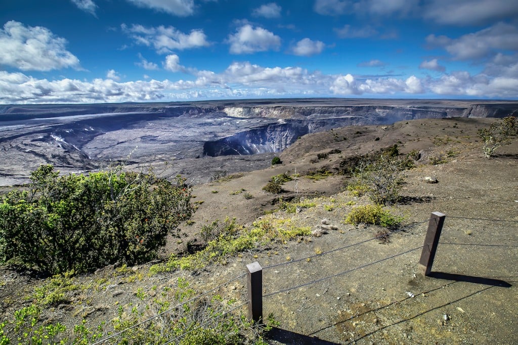
The view from Uēkahuna, the highest point on the rim of Kaluapele, the caldera of Kīlauea, is unlike any other—and the popular bluff has reopened this week after being closed since 2018.
That year, magma drained from Halemaʻumaʻu, the summit crater, triggering months of repetitive earthquakes, damaging ash clouds and the eventual collapse of Kīlauea summit. This unprecedented eruption caused major damage to roads, hiking trails and park buildings within Hawaiʻi Volcanoes National Park. Uēkahuna had to be closed for repairs.
Now, from this cliff top, you can see evidence of that destructive eruption, from the newly exposed yellow sulfur bank to the gaping chasm that is now Halemaʻumaʻu. On a clear day, you can see the slopes of Mauna Loa.
A half-mile of Crater Rim Drive and Crater Rim Trail west of Kīlauea Overlook to the Uēkahuna bluff parking lot have also reopened.
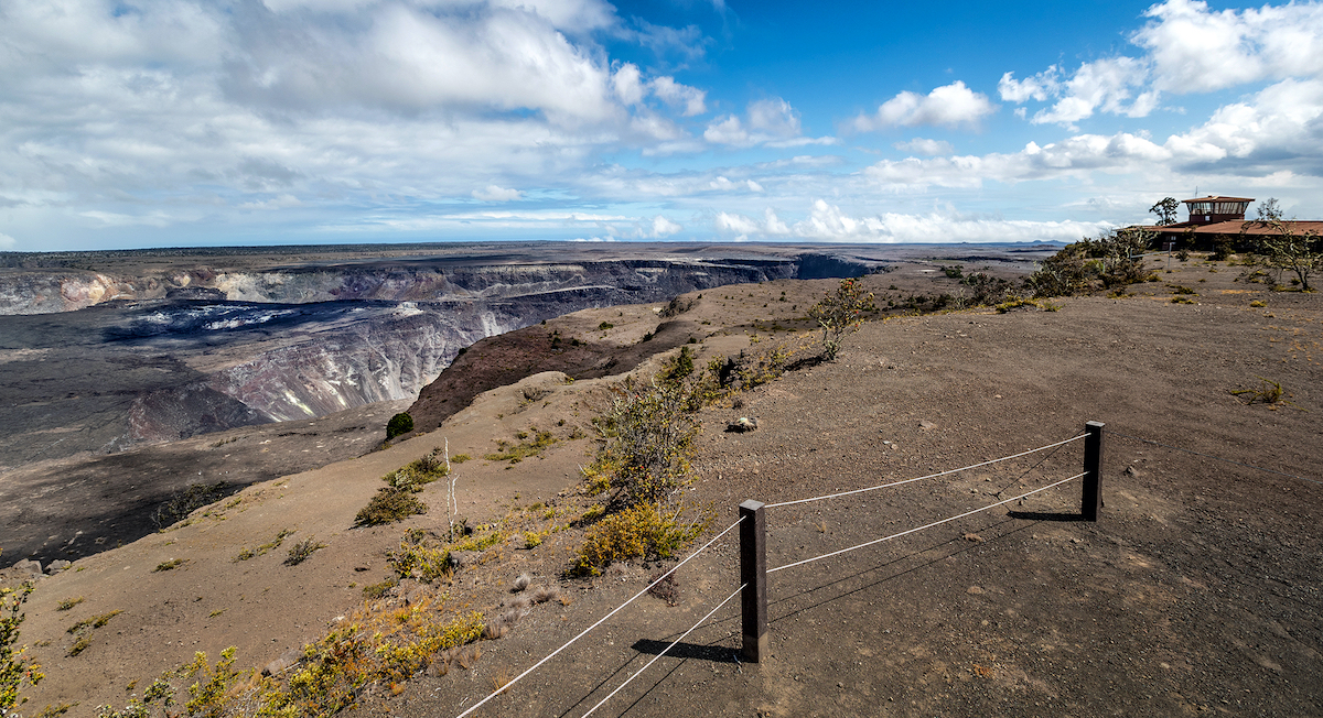
Uēkahuna viewing area with former USGS Hawaiian Volcano Observatory-operated facility in view
Photo: Janice Wei/National Park Service
“We are so pleased to welcome the community and visitors back to Uēkahuna, one of the most remarkable and revered sites in Hawaiʻi Volcanoes National Park,” said Superintendent Rhonda Loh. “Data from multiple post-disaster assessments indicate the areas do not pose an immediate risk as long as people stay on trail and stay away from the cliff edges. The National Park Service will continue to closely monitor the area, and respond as necessary to any changes.”
It took three years to get this overlook ready for reopening. Workers installed post and cable railing between Kīlauea Overlook to the west of the former Jaggar Museum (now closed and fenced off) to keep people away from hazards like undercut edges, earth cracks and sink holes. Safety signs mark closed areas, and the restrooms, signs and some trails have lights. The NPS also installed crack monitors between Kīlauea Overlook and Uēkahuna to determine changes that signal instability.
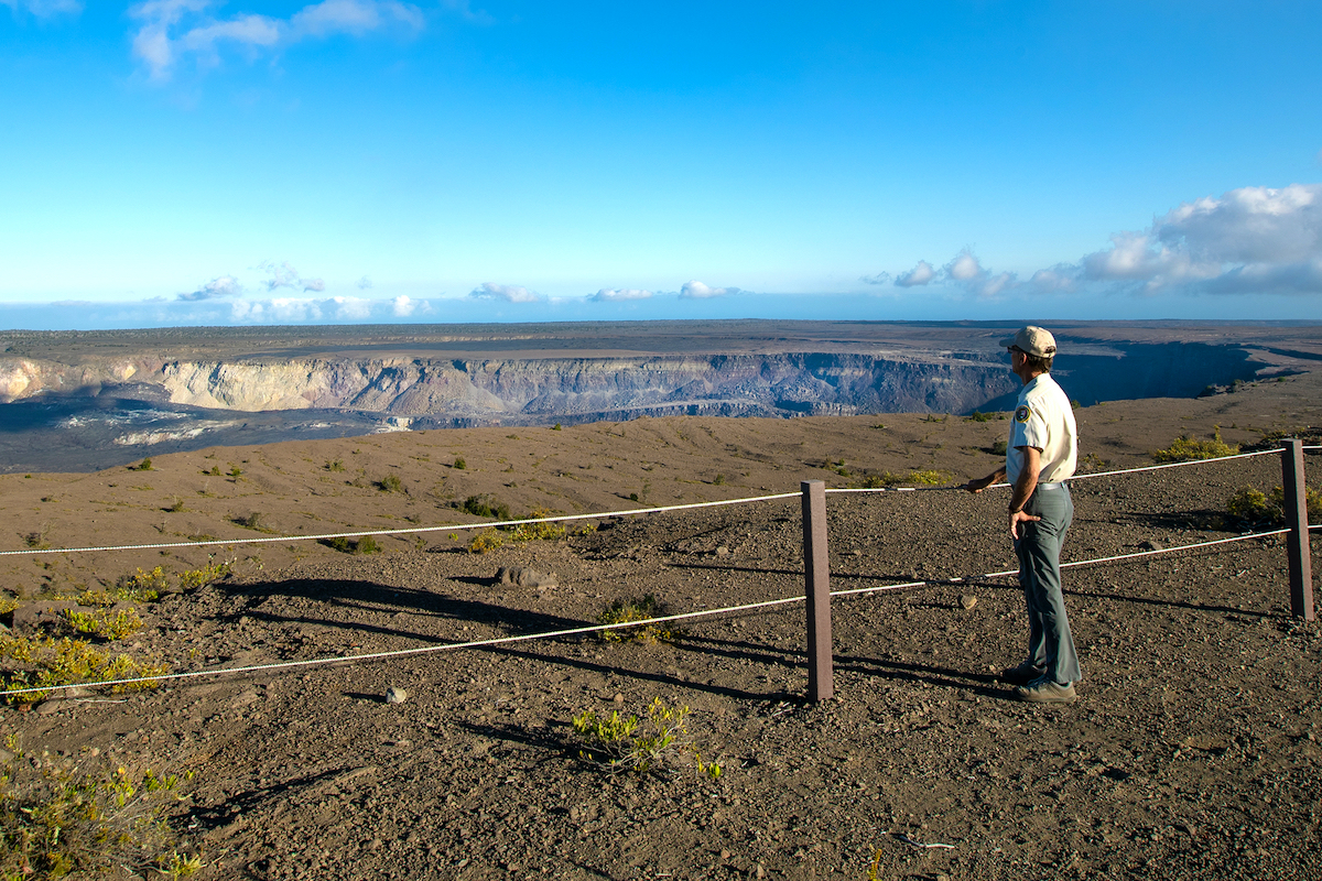
A National Park Service volunteer looks across Kīlauea summit from the Uēkahuna viewing area.
Photo: Janice Wei/National Park Service
In addition, the public restrooms near the former Jaggar Museum site and a half-mile section of trail connecting Nāmakanipaio Campground to Uēkahuna have also reopened.
At an elevation of more than 4,000 feet, Uēkahuna (formerly spelled Uwēkahuna) is the celebrated wahi pana (legendary place) at the highest point on the rim of Kaluapele, the caldera of Kīlauea. It’s an important site for Native Hawaiian ritual and cultural practice and offers breathtaking views of Kaluapele, Mauna Loa and surrounding areas.
For more information about Uēkahuna, visit here.