Updated: Hawaii braces for approach of back-to-back hurricanes, Iselle and Julio
Hawaii residents and visitors are watching two Pacific Ocean hurricanes today, which are expected to impact the Islands within days of each other. Forecasters now expect the first storm, Hurricane Iselle, to be downgraded to a tropical storm when it makes landfall on Hawaii Island tonight. The second storm, Hurricane Julio, was upgraded to a Category 3 hurricane this afternoon and is now expected to maintain hurricane strength as it passes just north of the Hawaiian Islands on Sunday and Monday (Aug. 10 & 11).
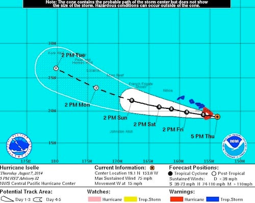
At 5 p.m. today, Hurricane Iselle was located about 90 miles east-southeast of Hilo on Hawaii Island, moving at 15 miles per hour towards the island and packing 75 mph maximum sustained winds. Iselle is predicted to pass through the center of Hawaii Island tonight with tropical storm-force winds between 60 and 70 mph. Forecasters expect to downgrade Iselle to a tropical storm just before it makes landfall on Hawaii Island tonight and passes just south of the rest of the state on Friday. Hawaii Island remains under a hurricane warning and flash flood watch. All other Hawaii Islands are under a tropical storm warning and a flash flood watch Thursday through Friday.
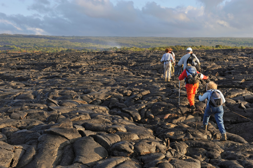
Regardless of its “hurricane” or “tropical storm” categorization, Iselle is expected to bring strong winds and heavy rains (about five to eight inches of rainfall), which may induce flash floods and rock- and mudslides. In addition, coastal areas may flood due to a combination of high surf and high tides.
As of 5 p.m. today, Hurricane Julio was located about 1,060 miles east of Hilo on Hawaii Island, moving at 16 miles per hour. At that time, Julio had been upgraded to a Category 3 hurricane, packing maximum sustained winds of 115 miles per hour. Forecasters now expect Julio to remain at hurricane strength through Sunday evening as it passes north of the Islands, and downgraded to a tropical storm by Monday evening. Storm conditions resulting from Julio’s current path could affect the north and windward shores of the island chain on Sunday and Monday.
Hawaii residents are currently preparing for the storms by stocking up on water, non-perishable food and other essential items. For more information on both storms and how to prepare for them, visit the National Hurricane Center webpage.
For continuing, regular updates on Iselle and Julio, visit the Central Pacific Hurricane Center website.
Hawaii-based air carriers Hawaiian Airlines and Island Air are issuing wavers to customers with reservations whose flights may be affected by Hurricane Iselle. Both carriers advise all customers to check the Hawaiian Airlines website and Island Air website for the latest flight updates. For more information or to find out if you are eligible, check the travel advisories for Island Air and Hawaiian Airlines.
The storm paths of both hurricanes are subject to rapid change. We are following both storms closely, and will post updates as necessary here on this post and on our Facebook page.