Here’s 5 More Scenic Roads in Hawaiʻi to Buckle Up For
These drives prove that it really is about the journey.
From highways to backcountry roads, if you spend just a little time driving in Hawaiʻi you’ll spot cars, minivans and trucks decked in decals with Island-style messages. One common bumper sticker advises folks to “Slow down, this ain’t the mainland.”
Although it’s meant as a quip, the phrase is a helpful reminder to enjoy the journey. And in Hawaiʻi, that’s easy to do.
Whether you’re driving up the coast with the clear blue sea as your companion or winding your way through the mountains with towering eucalyptus trees all around, slow down and enjoy the ride.
READ MORE: These Are 5 of Our Favorite Roads in Hawaiʻi for Scenic Views
1. Interstate H-3, Oʻahu

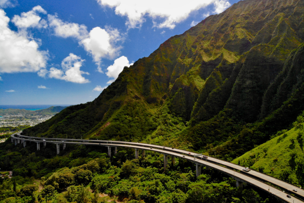
After heavy rainfall, you’ll spot waterfalls cascading down the mountains while driving on Interstate H-3.
Photo: Getty Images/Art Wager
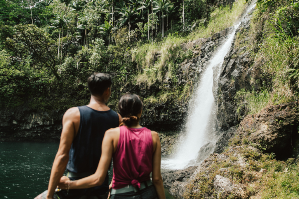
It’s hard to keep your eyes on the road while driving from Honolulu to the east side of Oʻahu on Interstate H-3. Cutting through the Koʻolau Range, you’ll journey through verdant Hālawa Valley for about 6 miles until you reach the Tetsuo Harano Tunnels. After heavy rainfall, you’ll spot waterfalls cascading down the mountains, and as drivers exit the tunnel, they’re greeted with breathtaking vistas of the Windward Coast and Pacific Ocean. Most days, you can see Kāneʻohe Bay’s multicolored sandbar. From here, you can continue on to Kāneʻohe, Kailua, the North Shore or even back to Honolulu along the scenic Ka Iwi Coast.
READ MORE: How the Interstate H-3 Came to Be
2. Hāmākua Heritage Corridor Drive, Hawaiʻi Island (Hawaiʻi Belt Road)

After 40 miles on the Hāmākua Heritage Corridor Drive, you’ll make it to the Waipiʻo Valley Lookout. One look and you’ll understand why this long trek is so popular.
Photo: Island of Hawaiʻi Visitors Bureau (IHVB)/@HungryHipsters
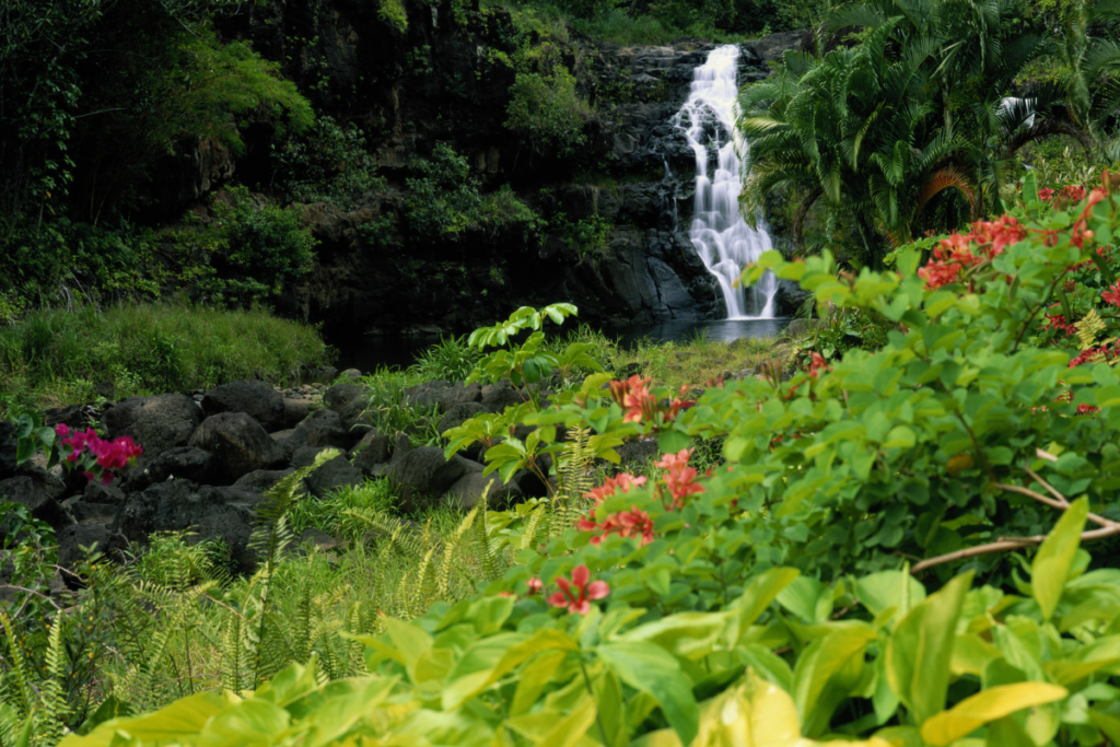
Stretching more than 40 miles, visitors can spend an entire day exploring the waterfalls, lush valleys and tropical rainforests dotting the Hāmākua Coast on Hawaiʻi Island. Known as the Hāmākua Heritage Corridor Drive, the journey begins in Hilo and ends at the Waipiʻo Valley Lookout—with ample options for detours in between. Many travelers start in north Hilo on the 4-mile Onomea Scenic Drive. Here you’ll pass over bridges and enjoy views of Onomea Bay. The road leads to the Hawaiʻi Tropical Botanical Garden, renowned for its collection of 2,000 plant species. As you venture farther north, you can stop at ʻAkaka Falls State Park to see a 442-foot waterfall. Then it’s on to Laupāhoehoe Point to stretch your legs and soak in views of dramatic sea cliffs. Kalōpā State Recreation Area is another great pit stop; here you can go for a stroll on the Kalōpā Nature Trail, a short 0.7-mile loop. After working up an appetite, reward yourself with sugar-coated malasadas from Tex Drive In in Honokaʻa. After 40 miles, you’ll make it to the Waipiʻo Valley Lookout. One look at the lush landscape here, and the black sand beach, and you’ll understand why this long trek is so popular.
READ MORE: A Visual Journey Through the Big Island’s Hāmākua District
3. Tree Tunnel, Kauaʻi (Maluhia Road)

With its canopy of 500 eucalyptus trees, Maluhia Road on Kauaʻi has been coined the Tree Tunnel.
Photo: Getty Images/EyeEm Mobile GmbH
A beautiful milelong canopy of 500 eucalyptus trees lines Maluhia Road on Kauaʻi; it’s been coined the Tree Tunnel. The road is a natural gateway to the towns of Kōloa and Poʻipū on the island’s south shore. Planted in 1911 by Scottish cattle rancher Walter Duncan McBryde, the trees have survived two hurricanes and remain a breathtaking site.
READ MORE: Getting to Know Kauaʻi, One Tree at a Time
4. Honoapiʻilani Highway, Maui

Honoapiʻilani Highway takes travelers right through Maui west-side towns and developments, as well as some of the island’s best beaches and restaurants. Stay on the road and you can find yourself at Honolua Bay.
Photo: Getty Images/Peter Unger
To get to Maui’s west side, the best route to take is Honoapiʻilani Highway. The 35-mile road starts in Wailuku and heads straight south to Māʻalaea Bay before turning north toward Honokōhau Bay. From Wailuku you’ll pass Waikapū, a small town that offers a glimpse into old-school Hawaiʻi, and Māʻalaea, home to the Maui Ocean Center. From there, drivers wind their way along the coastline, and in the winter it’s easy to spot breaching whales right from the highway. The road takes travelers right through Maui west-side towns and developments like Olowalu, Lahaina, Kāʻanapali and Kapalua, as well as some of the island’s best beaches and restaurants.
READ MORE: Take a Virtual Tour of Maui’s West Coast Beaches
5. The “Lower Road” from Kona to Waimea, Hawaiʻi Island (Queen Kaʻahumanu Highway)

From lava fields to rolling hills, you’ll cross diverse landscapes on your way to Waimea from Kailua-Kona on Hawaiʻi Island.
Photo: Island of Hawaiʻi Visitors Bureau (IHVB)/Elizabeth Brentano
If you’re headed to Waimea from Kailua-Kona on Hawaiʻi Island, taking Highway 19 provides a window into the Islands’ unique and diverse landscapes. The road cuts through black lava fields with the bright blue Pacific as the backdrop—and the contrast is striking. Also known as the “lower road” or Queen Kaʻahumanu Highway, it traces the northwestern coast of the island to just south of Kawaihae. Before reaching Kawaihae, you’ll come across a fork in the road. Turn right and start your climb up the hill into Waimea, the heart of paniolo (cowboy) culture on Hawaiʻi Island. The history of paniolo in the Islands predates the cowboys of America’s Old West. As the road continues, you’ll pass rolling hills along Kawaihae Road before finally reaching the charming town of Waimea at an elevation of 2,700 feet.
READ MORE: Your Guide to Waimea, Hawaiʻi Island